Pilot Program
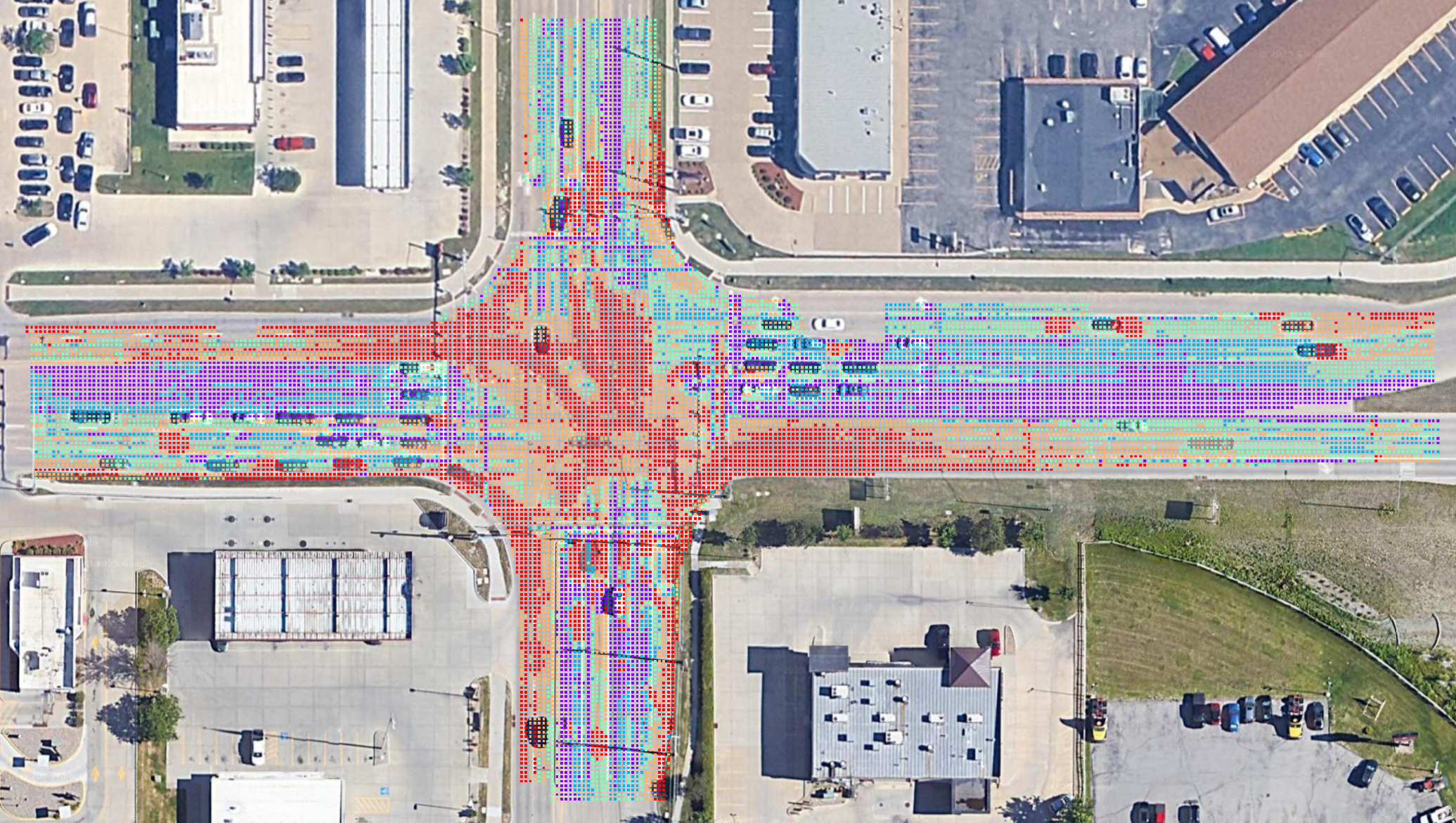
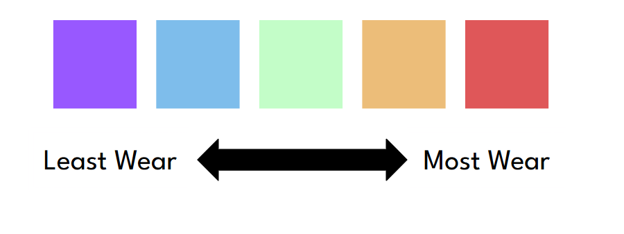
Asphalt Intelligence is a new way to screen roadway networks and flag areas for inspection. It does this by comparing the trafficked areas of road surface to the untrafficked areas and calculating the difference. Then it maps the results.
Seeking Partners for a Free 8-Week Pilot
We are currently inviting select agencies to participate in our FREE 8-week Early Access Pilot Program. The goal is to gather feedback from real projects and make sure the latest Asphalt Intelligence features work in the real world.
Program Overview
| Who We Are Looking For | What You Will Gain |
|---|---|
| Have active or upcoming road maintenance planning | Two months of FREE Pro access |
| Commit to an 8-week evaluation period | Up to 200 images analyzed per month |
| Have one primary user | Free QGIS plugin to prepare imagery and map results |
| Dedicate approximately 2 hours per month to testing | Output files compatible with ArcGIS, QGIS, Civil3D, OpenRoads, or standard .png |
| Complete a brief 5–10 minute feedback questionnaire | Opportunity to provide input for product improvements and new features |
There is no cost or long-term commitment.
For more information, contact us or schedule a 30-minute video call.