Overview
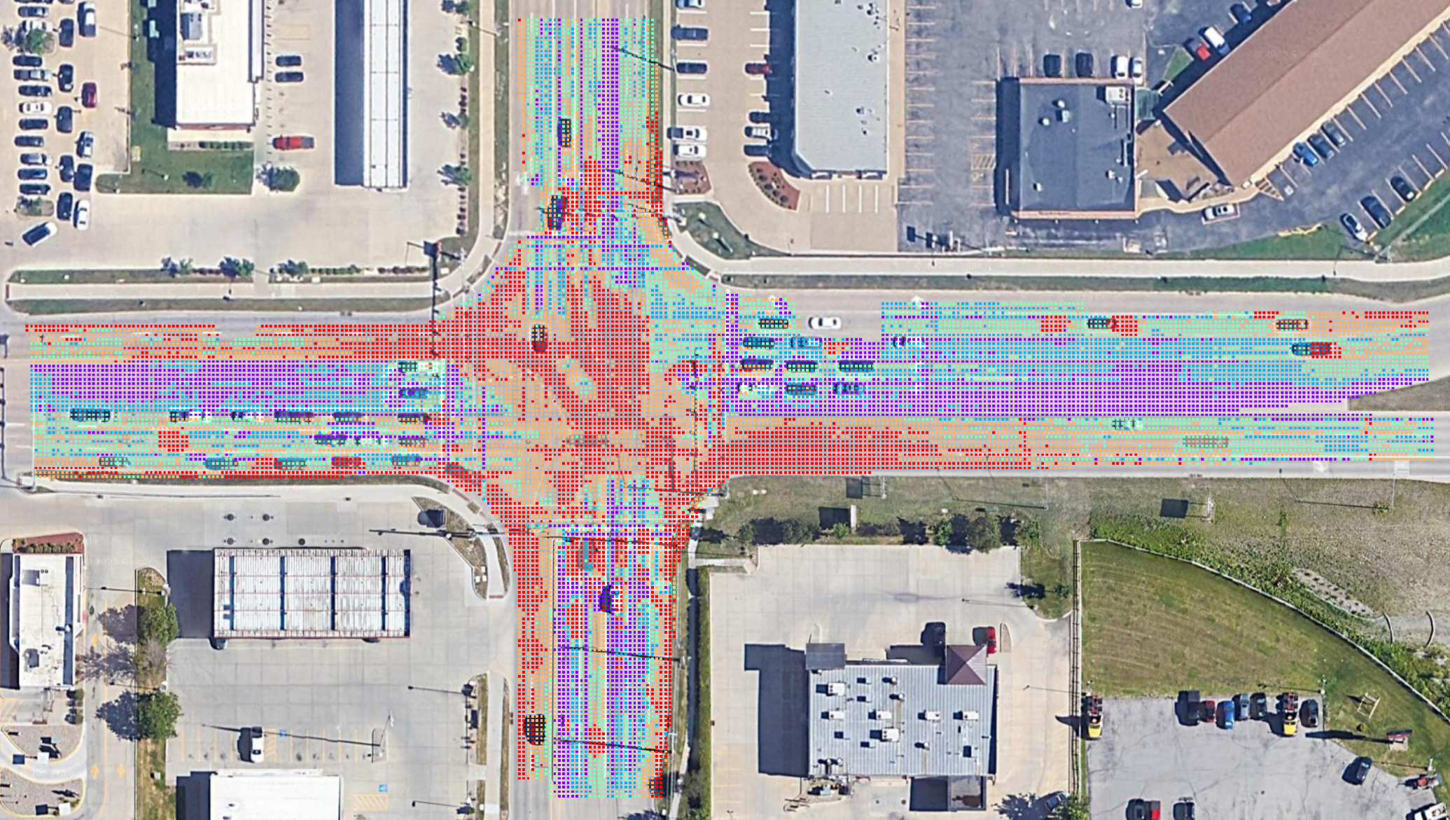
Turn Imagery Into Action
Color Scale Legend

Want to learn how the technology works?
How It Works →A Decision Support Layer Before Field Inspection
Asphalt Intelligence is a browser-based web application that provides a new risk-informed decision support layer before field inspection begins. Asphalt Intelligence supplements existing pavement assessment tools and workflows rather than replacing them.
The platform was developed specifically for transportation agencies that have finite resources and existing maintenance management systems already in place.
Teams of non-GIS users can log on to Asphalt Intelligence from any web browser, identify areas of interest, and view mapped output for the entire organization. Then, they can identify areas for further inspection and export the results in a format compatible with many existing GIS-based asset management tools.
Remote Screening
Asphalt Intelligence helps close the gap between what agencies already know and what they have the resources to physically inspect.
Inspection Prioritization
The objectives of Asphalt Intelligence are superior inspection prioritization, ability to identify opportunities for early intervention, and more effective communication between teams and organizations.
Support Existing Teams
At Asphalt Intelligence, we believe technology should support people. Our goal is to reduce the time it takes to identify roadways that need attention so teams can spend more time maintaining them.
Get Started
Operations & Maintenance
From the Office to the Field
Asphalt Intelligence was designed to make geospatial analysis of aerial imagery accessible to operations and maintenance personnel without GIS experience. The platform was designed to have a low training burden for operations staff with no GIS experience.
Training takes about an hour, and users can expect to be productive the same day. Users can investigate areas of interest in Asphalt Intelligence on Google Street View for web browsers in one click. Selected locations for field inspection can be exported as a KMZ file and opened directly in Google Earth on a mobile device.
Balance
Asphalt Intelligence is an easy screener that teams can use alongside existing reactive and preventative maintenance workflows.
Early Intervention
Remote inspection makes it easy for teams to screen the immediate areas surrounding a planned inspection, maintenance, or repair operation.
Return on Investment
Asphalt Intelligence maximizes ROI by optimizing team deployments for inspection and repairs.
Providing Situational Awareness Around Current Work
Asphalt Intelligence helps close the gap between what agencies already know and what they have the resources to physically inspect.
Asphalt Intelligence is an easy screener that teams can use alongside existing reactive and preventative maintenance workflows. The platform was designed to be used in the office for minutes before deploying teams to the field to screen the areas surrounding the planned inspection or repair.
This workflow can support opportunistic preventive maintenance that might otherwise be overlooked.
Providing Information for Major Investment Decisions
Remote imagery screening can provide a supplemental layer of information to help engineers, planners, and asset managers determine where to inspect for potential deployment of pavement testing and inspection resources.
This layer of information is relatively low-cost and can be used in conjunction with other data to make major investment decisions on future projects.
Vendor or Enterprise Questions?
Contact Asphalt IntelligenceEnterprise
Pavement Screening for Organizations
The output is automatically brought into a common data environment, so users can compare the Asphalt Intelligence output with existing data. For instance, visual overlays or current pavement squares / roadway segments can be used as reference layers.
Users can right-click on any area of the map or drag the person icon to inspect that location on Google Earth Street View. Users can export a KMZ of the centroid of each job flagged to easily send to field crews on mobile devices.
Users can select Asphalt Intelligence jobs by clicking on the map and then either export the map as a georeferenced image for integration with GIS projects or export the data from the Asphalt Intelligence job (date, time, location, matching pavement square / Supersegment ID, user) as a CSV for integration with existing workflows.
Integration With Existing Platforms and Workflows
Asphalt Intelligence was designed to integrate output with existing jobs management systems, GIS-based asset management systems, and inspection / maintenance workflows.
Modular Component of DST. Asphalt Intelligence can operate independently for Streets or as a specialist component of a broader DST framework. The platform is NOT a replacement for Esri, CentralSquare, or other systems. Change management requires no migrations or installations.
Output in Open Data Formats. All output is in open data formats as either .csv, .png, .geojson, .kmz, or .geotiff file extensions. This means users always can access their own data, regardless of subscription status and no additional subscriptions are required.
Georeferenced Output. All Asphalt Intelligence output is georeferenced and can be matched with existing pavement squares before export with an Enterprise plan.
Asphalt Intelligence output currently integrates with many asset management systems using CSV based workflows.
Selected locations for field inspection can be exported as a KMZ file and opened directly in Google Earth on a mobile device.
Users can export the map as a georeferenced image for integration with GIS projects.
Esri and GIS Compatibility
Asphalt Intelligence currently supports Esri-hosted basemap and imagery services. Asphalt Intelligence output is compatible with many current Esri environments. Direct integration of Asphalt Intelligence with an agency’s GIS layers for image processing can be evaluated, if desired.
API Capabilities
Current workflows support retrieval and formatting of GIS layers from public ArcGIS databases. Direct integration with REST APIs can be developed to streamline data exchange.
Vendor or Enterprise Questions?
Contact Asphalt IntelligenceVendor Information
Capability Statement
All development and support are handled in-house. This gives us direct control over software quality, security, and customer support. It also allows us to customize workflows and continually update the platform based on customer feedback.
Bespoke enterprise solutions and development opportunities are also available for agencies interested in more automation and easier integration with existing platforms and workflows.
Straightforward Deployment
Purpose-built for pavement screening and transportation maintenance workflows.
Development, implementation, training, and support are managed in-house.