
Remotely monitor road surfaces
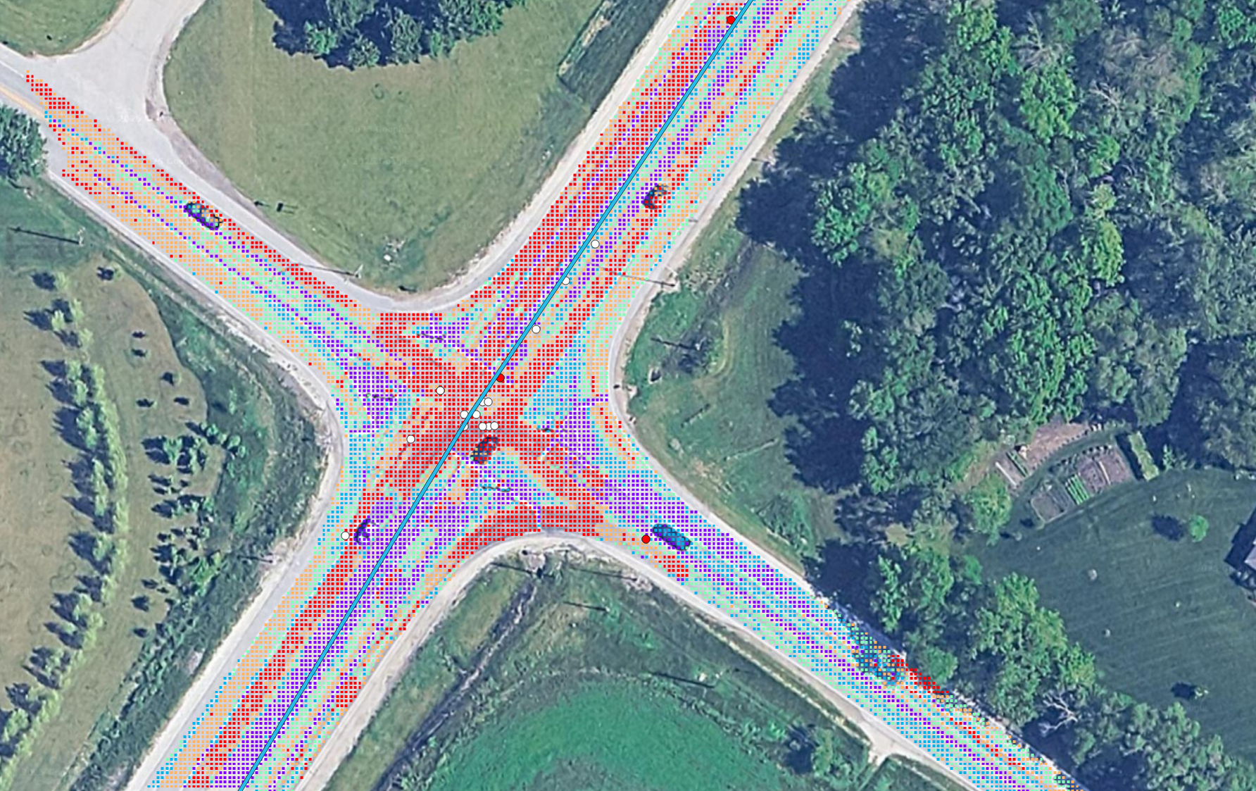
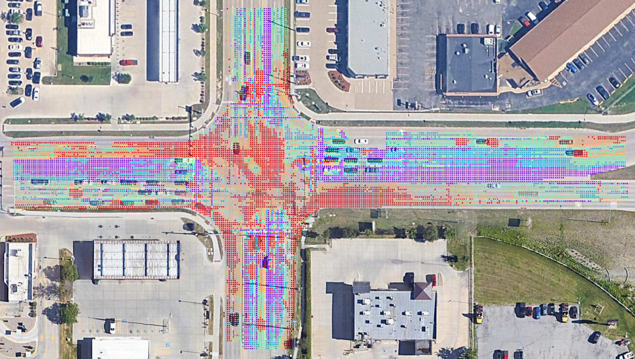
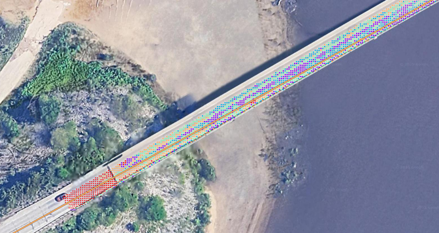
Asphalt Intelligence is a tool that helps people remotely monitor road surface by analyzing aerial imagery.
Screen for further inspection
Asphalt Intelligence uses a computer vision model calibrated with historic pavement testing data and accident records.
Make decisions that save lives
Asphalt Intelligence makes it easy to get valuable data about which parts of the road surface are subjected to more wear and damage than others, and might need attention.
Key Features
- Browser-based web app, no install required
- Affordable subscription plans
- Analyze open-source imagery or your own uploads
- On-demand training content and walkthroughs
- Start analyzing aerial imagery in minutes
Potential Use Cases
- Monitor residential streets near planned paving operations
- Monitor roadways near planned and unplanned utility work
- Screen for optimal deployment of inspectors and testing units
- Optimize existing maintenance and repair operations
- Map and share results with the official QGIS Plugin